Last Morning of Record Cold - Digging Out the Rest of the Week

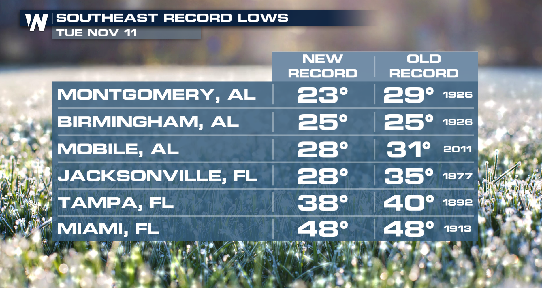
The season’s first Arctic blast surged into the South, arriving nearly three weeks ahead of meteorological winter, which begins December 1. Driven by a deep upper-level trough, this system has funneled frigid Canadian air all the way down to Texas. Multiple record lows were set over the past few days across the south and southeast. The good news: we're warming back up!
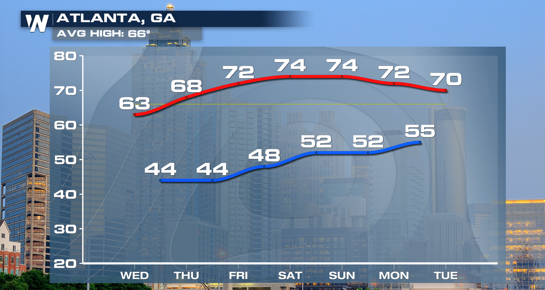
We will see a pattern change this week, with temperatures becoming average, and then above average as a high-pressure system ridges back in by the end of the week!
Get forecast details for your section of the country with our regional forecasts, which air at :10, :30, and :50 past the hour from east to west. You can also watch the latest forecast anytime with the WeatherNation app!


